Showing posts with label Kayaking. Show all posts

Tuesday, March 17, 2009

Magnolia River 17 MAR 09

Spring kayaking begins

Finally. Taking advantage of spring break to get some kayaking in, since my truck broke down (killkillkill) and I couldn't spend the week at St. Stephens (killkillkillkillkill.)

I'm pretty much stuck between Mobile and Baldwin counties. Not too much of a problem, since the weather is finally spring-like, and the trackless waters of the bay beckon. Today I headed over to Weeks Bay and the Magnolia River for the first time in two years.


Not a cloud in the sky. Last time I made this run, we got run out of the water by an afternoon thunderstorm that seemingly popped up out of nowhere.

6.77 miles, not a bad way to spend two hours on a mild spring afternoon.

Tuesday, December 9, 2008

Fowl River 9 DEC 08

Icy Hot is my friend

I've been paddling these waters for over 2 years now, but haven't once tried out Fowl River. This is a unique little river. About a mile and a half inland it forks north and south. The southern branch, known as West Fowl River, runs nine miles south and west to empty into Mississippi Sound. The northern branch just trails off toward Tillman's Corner, but it's a nice run. In four hours today I covered 15 miles, still working up to the planned 27-miler. I feel great! Kicking up the paddle trips a notch, in addition to some minor dietary changes (practically eliminating caffeine and sugar) have me feeling great. Not to mention, finals are over, so I can take it easy for a short while.


Launch: Fowl River Marina
Route: Upriver past Bellingrath Gardens, then north to Fowl River Rd. bridge, and back.
Time: 4 hours, distance 15 miles.
Weather: Overcast and warm with intermittent heavy rain.

This is Fowl River, so here are some pictures of foul weather and waterfowl:


Tuesday, November 25, 2008

Big Creek Lake 25 Nov 08

I haven't been to Big Creek Lake in 11 months, so today I cinched the kayak to the top of the truck and went down to the end of Howell's Ferry Road. When you're too cheap to invest in a rack for the top of your beater pickup, you have to be creative when you strap a kayak to the top of it. It took a few tries to come up with an arrangement that provided a secure tie-down without bending the hull of the boat or denting the roof. Resting the kayak on the aft edge of the truck's roofline bottom-up works. The foam block on the roof rests right over the watertight bulkhead behind the kayak's seat, so the keel won't be squashed by the tiedown straps. The forward bulkhead rests on a foam block on the truck's tailgate, and is held down by a strap hooked to the rear bumper. This provides a rock-solid tiedown with minimal strain that stays put even on the interstate at 80 mph.
Today's trip was a hard paddle to the north end of the lake. The last time I took this route was February 2007. Since the water levels are back up again, I was able to go all the way up past Highway 98 and then a further mile north into Big Creek itself, past a rail bridge that hasn't been accessible by water for several years. This is also the longest trip I've taken in months, clocking in at 12.3 miles. For the immediate future there's going to be a greater emphasis on distance in my paddle trips. There's a method to the madness, a 27-mile method: I'm conspring with my friend Dan to take a day and paddle a marathon distance. Conveniently, paddling the Tensaw River from the Lower Bryant Landing to the Mobile Bay Causeway covers 27 miles.

Hopefully we'll make this run in the late winter or early spring, but before I reach that point I need to engage in some more conditioning. I covered 12 miles today without much trouble, and I intend to add two miles to every successive paddle trip from here on out.

Picture roundup:


Friday, November 14, 2008

Picture round-up

Odds and Sods

Chickasaw Creek and Dauphin Island from trips over the summer and fall:


Thursday, November 13, 2008

Chickasaw Creek 12 Nov 08

Creek water for the soul

I normally prefer to kayak on gray, overcast days. The glare of sunlight reflecting off the water can give me headaches from squinting, even with sunglasses. In the summer I typically wait until late in the day to go out, as conditions cool and the sun sinks to the horizon.

Rain doesn't bother me much; I carry excellent rain gear on paddle trips, and wet weather imposes a stillness and silence on my surroundings that I find to be extremely soothing. Sometimes I just set my paddle down and float idly as the rain comes down, unwilling to disturb the rain-calmed water or interrupt the silence.

Wednesday afternoon was my first time out in a few weeks. The skies had threatened rain for most of the day, so I strapped the boat to the top of my truck and headed up to the creek, hoping to relax and enjoy a bit of light rain along the way. There are few better feelings to me than paddling on calm, still water on a fall afternoon. Whatever stressors are affecting me at the moment feel as though they're channeled down my arms to the paddle, grounded and dissipated in the water.

Rainfall was sporadic and light. At least it was light until I cinched down the last strap when I loaded up to go back home. The skies opened up right as it got dark. I like rain, but I wasn't in the mood for a downpour at dusk. Anyhow, not pictured are a few small pockets of light fog that formed at tight bends in the creek, where cool air settled and the light breeze couldn't reach. A beautiful, quiet afternoon out. All told I covered about five miles, paddling around aimlessly with no set mileage goal, just killing time.

Kayak Round-Up

Down the Memory Card

Over the last several months, I've taken a handful of trips and not had the gumption to post pictures or summaries. With summer long gone, I think it's fitting to reminisce on some of the trips I took, and remember some scorching hot days on the water as I freeze my ass off now.

In August and September I took some time to paddle around Dauphin Island, specifically after Hurricanes Gustav and Ike. Gustav barely caused any local damage, save for accelerated erosion on Dauphin Island; it severed Sand Island from the mainland (for the first time in a year) and made it possible to pass from one side of the fishing pier to the other without a 7-mile circumnavigation of Sand Island. Ike was a different story.

Although Ike bored in on Galveston, its effects were felt all along the Gulf coast. Waves churned up by a storm 300 miles offshore still succeeded in washing out and closing the road to Dauphin Island for a day or two, and churned up massive amounts of sand. This effectively filled in the 6-foot-deep moat around Fort Gaines and undid years of beach restoration:

This picture was taken on a spot where 5 acres of sand eight feet above the high-tide mark once sat:

Also, I have finally taken some pictures of dolphins at the surface. For the last two years the little buggers have had a knack for submerging just as I set off the shutter on the camera:
Click on the picture to zoom in and look in the upper left corner.


Fin shot in the middle left. You didn't think the bastards were going to strike poses, did you?

Later I'll catch up on a bevy of trips I've taken to Chickasaw Creek. Since drought conditions here have effectively ended, the water levels there have risen to a point where I can paddle over logjams that stopped me short earlier, opening up miles of water previously inaccessible to me.

Thursday, April 10, 2008

Dog River, 8 APR 08

Bataan Death Paddle

I haven't been out on Dog River since December 2006, when I only went five miles downriver, wimped out, and paddled back. This time I was determined to paddle its entire length from its headwater near Navco Road to Mobile Bay and back. 15 miles in four hours, give or take:


Since I haven't been out in a couple of months, this was especially grueling. Something's wrong with my right shoulder, which continually reminded me that it was pissed off from about mile 6 onward. Still, not a bad way to spend my first off-day in a couple of weeks!


Approaching the yacht club and bridge:

There was a small craft advisory out in the bay, just a bit of a swell running. Got hairy for a few minutes while I went out a short distance past the bridge:

Taken as I turned about and put the bridge in my wake:

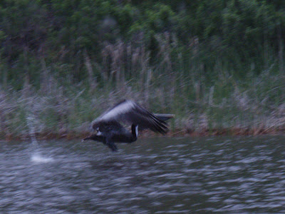
Pelican on the wing:


Exhausting. Grueling. I wouldn't change a thing.

Wednesday, June 6, 2007

More stuff you might not have seen

Filler


It's becoming harder to find time to kayak. New semester, new job... Blah.

Saturday, June 2, 2007

Inadvertent Art

All I'm capable of

I took this one on a sunset paddle recently. The camera's poor low-light focus allowed this ethereal shot. Very Munch-ish. "The Splash," anyone?
Or this blurry mess taken moments later:
Some have gone far with less....

Tuesday, May 22, 2007

Biloxi, MS 18 May

Progress?

I decided to take my kayaking over state lines last week with a trip to paddle Biloxi. Ravaged by Katrina's winds and nearly annihilated by a 30-foot storm surge, Biloxi is still slowly picking up the pieces, instead of pointing fingers of blame and whining about the lack of willing participants in its reconstruction, like its over-publicized neighbor (New Orleans). Biloxi has hardly drawn any national media attention at all over the last 21 months, since its citizens have their shit together and didn't let their city descend into headline-news chaos. I knew I loved the place. Hell, I was born there.

That being said, This was my first foray into the disaster area, to see it up close. Mobile copped it pretty badly from Katrina, but nothing on the scale it reached just over the state line. I set off from what was left of a public marina next to the nearly-rebuilt Hard Rock Casino, which has been in reconstruction for the last two years. I covered 12 miles in four hours, with a northerly wind and pleasant (low 80s) weather.

The chief revenue-generators in Biloxi (and Mississippi for that matter) are the casinos on the coast and along the banks of the Mississippi. Few survived the storm in operable condition. Here's a picture of the remnants of Casino Magic, still in disrepair with only one work crew on-site. The hotel still stands, but the barge that once supported the casino itself was washed off its moorings and has since been broken up for scrap.

The waterfront is coming back to life, as this beautiful schooner with a full complement of tourists attests.

The bridges over the mouth of the Back Bay between Biloxi and Ocean Springs didin't stand a chance, as the surge was high enough to lift the span sections off their piers and drop them into the water. The westbound span of the Highway 90 bridge is about half-rebuilt, and construction has only just begun on a new eastbound span.

Just north of the US90 bridge, the Howard Avenue bridge didn't fare any better. Since its span was only 4 feet above the waterline, it had no chance; this bridge had to be rebuilt after Camille in 1969 and then after Frederic in 1979. Untouched since Katrina, this bridge gives you some idea of what US90 looked like before reconstruction began, and the power of a storm surge with wind and tide to back it up.

Just past this bridge I entered the back bay, where a great deal of damage remains. Abandoned marinas, debris left where the surge deposited it, and another damaged bridge. Shore damage notwithstanding, the shrimp fleet seems to be in pretty good shape, albeit thin on the ground.

Speaking of shrimp boat docks, I wonder when they're going to clean this up:

After this shot, I pressed on another mile past I-110, until I was just north of Keesler AFB before turning around to head back. On the way back, I had another dolphin-run in and more unsuccessful attempts to take pictures. Maybe next time.

On saturday I went on a MBCAKC group paddle to an island in the Tensaw delta with a large cluster of ancient Indian mounds. I'll be writing that up soon. It was a good picture-taking trip.